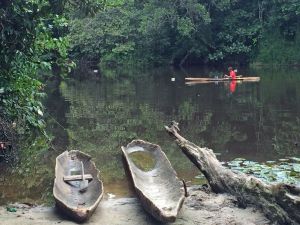
I came to Gabon to better understand how rural communities use and value their natural resources, and what factors might explain differences in villages across the region. This, of course, is an impossible task without the collaboration of community members that know and work with the land on a daily basis. Community mapping can be as simple as it sounds – working with a group of community members to draw out a map, on paper or even in dirt on the ground, of how they use the natural resources around their village.
I set out to work with 10 villages (no small task!), and after a few villages in I quickly developed a routine. Here’s my typical day of community mapping.
5:30am – Rise and shine. Since the project area spans over 150km along highways of red dirt, my day starts before sunrise. The inside of my field pack looks like I’m heading to arts and crafts – poster paper, colored pens, colored paper, and tape. Throw in a GPS, voice recorder, and small thank you gift for the village, and I’m ready to hop into the Land Cruiser.

6:30am – Marché. To start the day off right, we make a quick stop in the city market to stock up on sardines and baguettes for lunch in the field. And, of course, my now typical breakfast: baguette with chocolate spread for a mere 30 cents.
7:15am – A patient wait. After 30-45 minutes on the dirt highway, we arrive in the village for the day and take a quick drive through the village to announce our arrival. We find a central place in the village, often the village chief’s house, with enough space for a large group and somewhat level ground (a challenge!) for the mapping activity. Then we wait, patiently, as men and women slowly trickle in, many donning the incredible West African clothing patterns that never cease to amaze me.

8:00am – Community mapping. As is tradition with community meetings, the village chief says a few words to open the discussion and then it begins. Starting with a basic plan of the village, we draw out the cassava plantations just behind the houses, water springs for drinking water, rivers and streams for fishing, sacred areas for traditional ceremonies, and other areas in the forest where wood, fruits, and medicinal plants are collected. This does not change drastically from village to village. However, the ways in which their resources are threatened do change: mines polluting water sources, elephants damaging plantations, commercial hunters encroaching on village hunting territories, just to name a few. The maps are a key part of my research, but by leaving a copy with them it can also be a valuable resource as they consider and develop conservation projects such as community forests, which several villages have already started pursuing.

10:00am – Village tour. After thanking everyone for their generous time, and giving a small thank-you gift, I set out into the plantations and forest around the village collecting GPS data to ground the community maps we just created. Once again, I couldn’t do this without the help of community members inviting me to walk through their plantations, showing me where they collect water, and pointing out hunting trails and the small animal traps hidden along the trail. A sturdy, fallen log along a forest trail makes the perfect spot for a sardine and baguette lunch.

2:00pm – Parting gifts. After hours of mapping, talking of elephants and industry, and weaving through mazes of cassava plantations, the work day is over. Sometimes I’ll be invited into a home for a freshwater fish and cassava. Other times I’ll return to the research station bearing edible gifts. The list so far has included 8 ears of corn, 3 chocolat fruits, 2 longhi rouge, a handful of atanga and 2 bunches of bananas.
Each village has a unique story, and I’m incredibly grateful to have been so welcomed into each one of them. But the summer is not yet over, and I’m looking forward to the stories I have yet to hear.


Great to see you are working in Gabon this summer, Nina! Hope to have the opportunity to hear more about your experience when you are back at Duke.