2,800 miles, five states, 6 rivers, 12 days… it’s been another epic hitch sampling streams for the BLM’s Western Rivers and Streams Assessment Project. Although the sampling design was randomly generated to produce an unbiased data set, multiple strata were built into the model to ensure that streams and rivers of all sizes were included in the sample pool. Because many of the larger order rivers are not safely wadeable, an abbreviated protocol designed for sampling from a boat was produced by the EPA. The “boatocol” generally takes less time to complete than wading sites, but numerous other logistics stemming from the necessity of scouting river access points, running shuttles, and rowing to the sampling site, made for several extremely long days during this hitch.

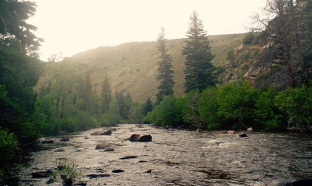
As mentioned previously, the study sites for this hitch spanned a large geographic area; we sampled the Red Rock in Montana, Cheyenne in South Dakota, Encampment in Wyoming, Yampa and Little Snake in Colorado, and the White River in Utah. The rivers were as diverse as their geographic locations. For example, the Cheyenne is a slow moving sediment laden Great Plains system, while the Encampment River is a high gradient cobble and boulder dominated creek. The exposure to such an eclectic array of rivers remains one of my favorite aspects of working on the WRSA project.


One of the major differences between boatable and wadeable sites is the accessibility of the sites themselves. When sampling from a raft you only have one chance to collect measurements as you travel down river; wading upstream to collect missed information is just not possible. Data collection is also limited to only one bank; ferrying across at each transect to collect more detailed data would be annoying in the slowest moving systems and downright impossible in larger volume rivers. Due to the one pass one chance nature of boating there is more prep work that must be done before sampling. Using google earth enables us to set up our sampling transects before even leaving for the field (vs using a tape measure upon arrival at the x-site). By inputing the coordinates into our GPS, we are able to navigate down river stopping at each of the 11 transects we must sample. The majority of the boatocol is easier than the wadeable protocol due to its simplified nature, but thalweg measurements are the exception. The thalweg is the part of the channel where the majority of water is flowing, and is usually the deepest section. At both wading and boating sites 10 thalweg depth measurements must be taken to obtain a longitudinal profile between each transect. In swift, deep rivers, coordinating navigating, rowing, thalweging, and recording data on the ipad is the trickiest part of the day.

Nine times out of 10 the portion of the day spent collecting data is a mere fraction of the hours worked to ensure that each site is sampled. To illustrate this I’ll give a snapshot of our three days spent working on the Cheyenne. Day 1 was a driving day only, thirteen hours of driving in fact. The Cheyenne is the only targeted river in South Dakota, and may be the most easterly site of the WRSA project. Upon arriving in Wall, SD on day two, we had to drive to the theoretical put in that we had scouted virtually on google earth. Just because we are able to identify what looks like a dirt road leading to the river on the computer doesn’t always mean there is access. Each sampling site is located on BLM land, but getting to that pocket of land often involves traveling through a patchwork of private property. About an hour into our scouting drive through ranch country we met a slightly hostile local who informed us that the road was gated further ahead. This proclamation ended up unfounded, and we were able to obtain permission to launch our raft from the Link property (that’s Link as in Jack Link beef jerky). Luckily the office had previously gotten in touch with a farmer downstream that granted us permission to use his land as a take out… the catch, it was a 3.5 hour drive from the put in- one of the most epic of shuttles for a stretch of river that was less than 10 miles. The third day on the Cheyenne was the longest day of the hitch,18.25 hours. The day began with renting a car at the Rapid City airport at 8am and ended with us rolling into our campsite around 2am after shuttling the vehicles. An exhausting day, but a successful one or sure.

Most of the other rivers were less logistically intense than the Cheyenne, but all involved extra legwork that would not have been necessary at wadeable sites. My favorite system that we worked on was the White River. This may have been because it was our only overnight river trip, but it was also because the river flowed through a spectacular canyon displaying a rich geologic history. Because of a lack of public access points we had to float 37 miles to get to our sampling location, which meant that an entire day of work consisted of traveling down river towards our site. River travel is one of my favorite methods of transportation and camping on the beach and waking up by the river is one of my favorite things. My next (and final) hitch is also a boating one, and we will be sampling sites mostly in Colorado, for which I am very excited!


